
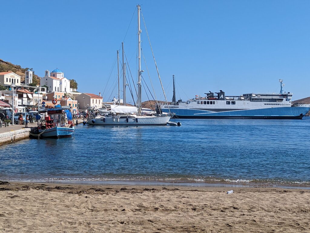
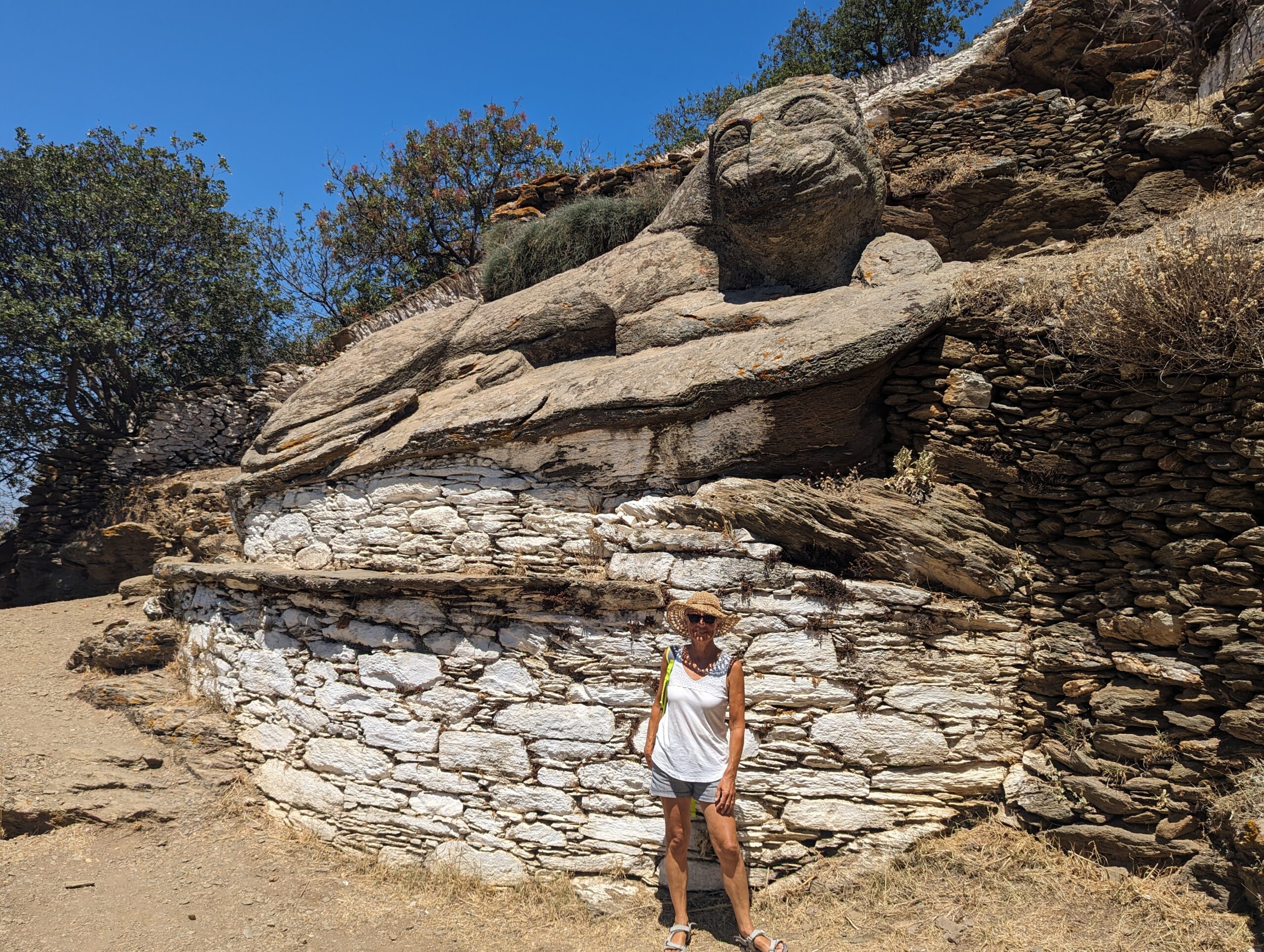
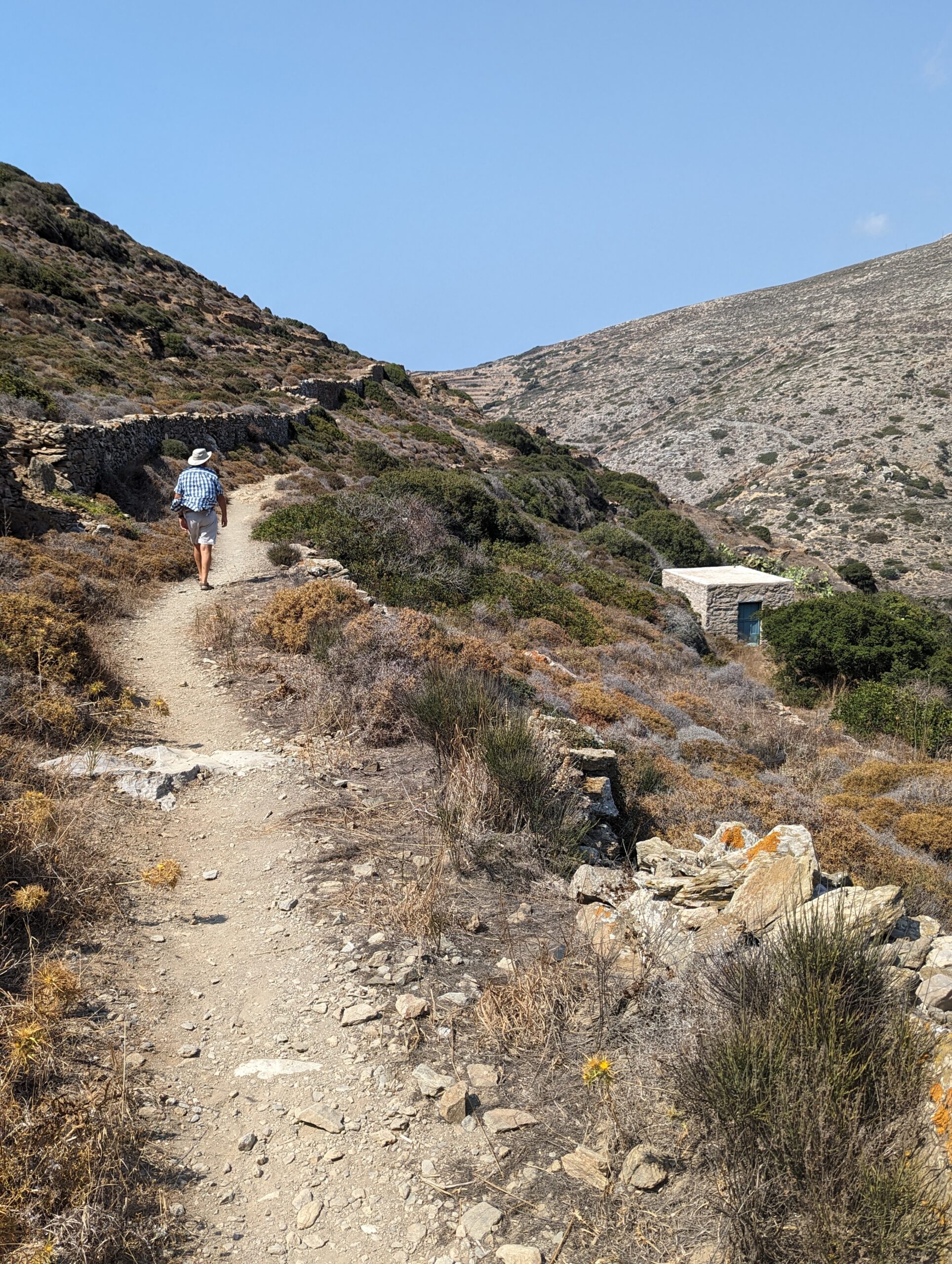
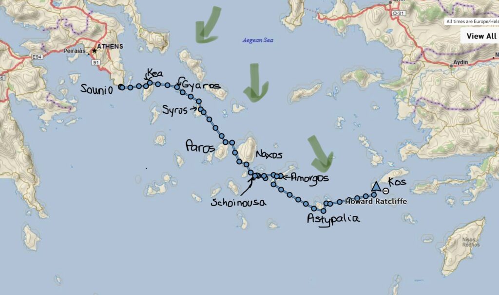
Sounio Bay, with its temple to Poseidon, was our last anchorage before we departed for Kea, an island in the Cyclades closest to Athens. We had planned to cruise the Cyclades throughout the month of August. However, as mentioned previously, July and August usually have the strongest Meltemi winds so our route through the islands was predicated by the vagaries of the weather. We experienced a gentle downwind sail most of the 16nm passage to Kea. The island has a large protected bay on its NW corner, which is very busy with multiple ferries and yachts. The anchorage off the fishing/tourist village of Vourkari was too congested so ultimately we Med-moored (stern to) off the town dock in Korissia. We had initially anchored but the harbor master told us we had to move because during southerly winds the ferries needed more space to maneuver. Kea is a mountainous island and now a tourist destination for Athenians. A bus ride took us to the chora (Greek for the main town on the island; its true name is Ioulis). The town is high up the mountain and has great views. Many towns on islands in the Cyclades were built high in the hills to limit attacks by pirates. Kea is famous for its lion, carved out of stone pre 600 BC. The walk through the hills to find it was very pleasant.
Kea was first settled during the Bronze Age and also, like Aegina, minted its own coins. It reached its height of influence during the late Minoan/early Mycenaean eras (1600-1400 BC). Coins from the 3rd century BC often feature dogs or stars. Inhabitants in a previous time made sacrifices to the Dog Star, Sirius. The Venetians captured the island from the Byzantines, who had built many churches on the island, after the 4th Crusade in 1204. They built a castle in Ioulis, the remains of which are still there. Overall quite relaxing, with amazing scenery, history, and many restaurants.
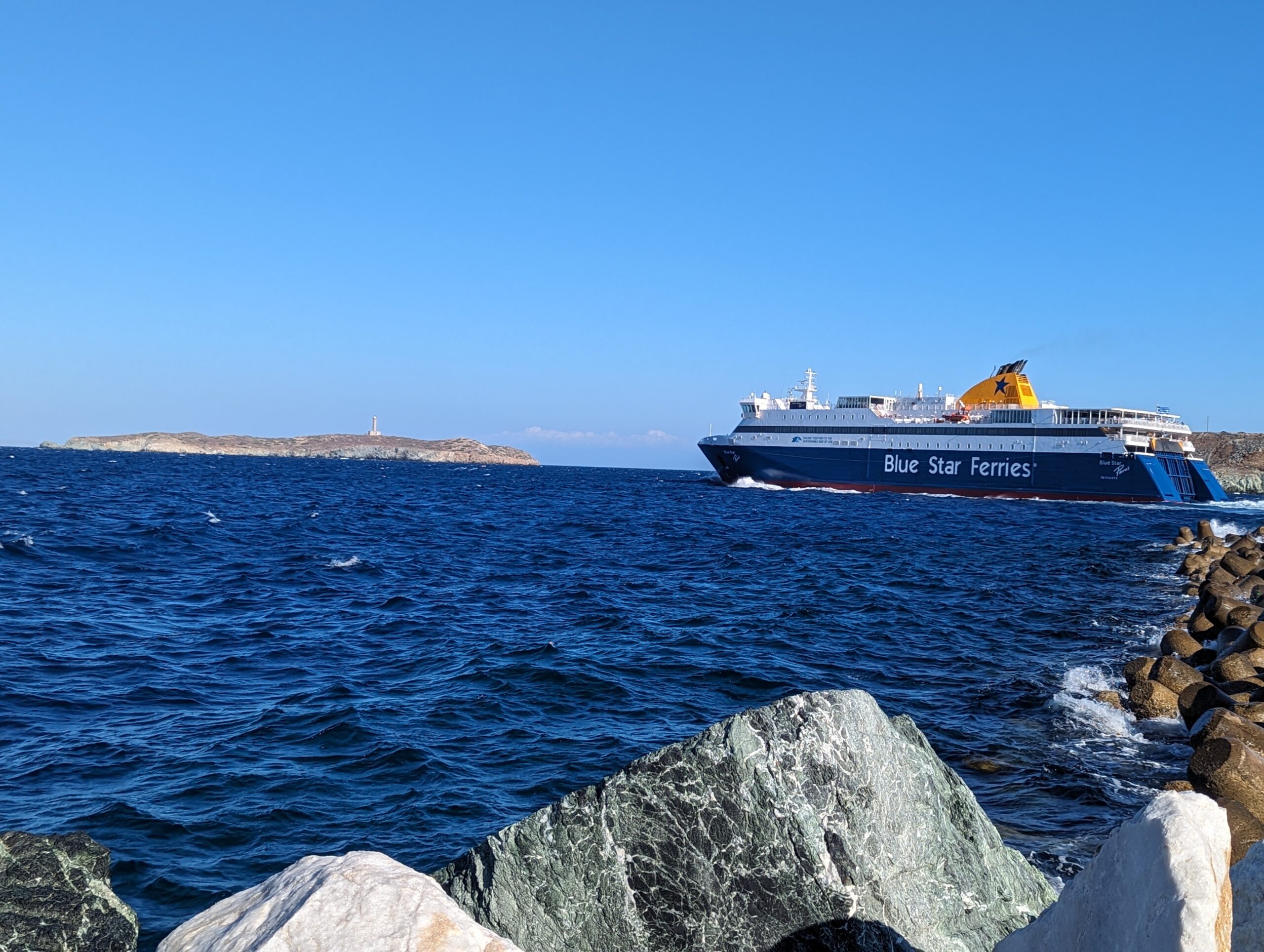
The Britannic, the third sister ship to the Titanic and Olympic was sunk off Kea in 1916, during the first World War, after hitting a mine.
Prior to setting sail for Gyaros and Syros we spent considerable time reviewing the forecast. Unfortunately the Meltemi was to be in the 25-40 knot range within a few days. Accordingly, we had to cancel our plans for visiting Tinos and Dilos (an island of significant archeological interest), and instead headed for Syros, via Gyaros. We had to motor the 25nm to Gyaros. That’s sailing in the Med; either too much or not enough wind.
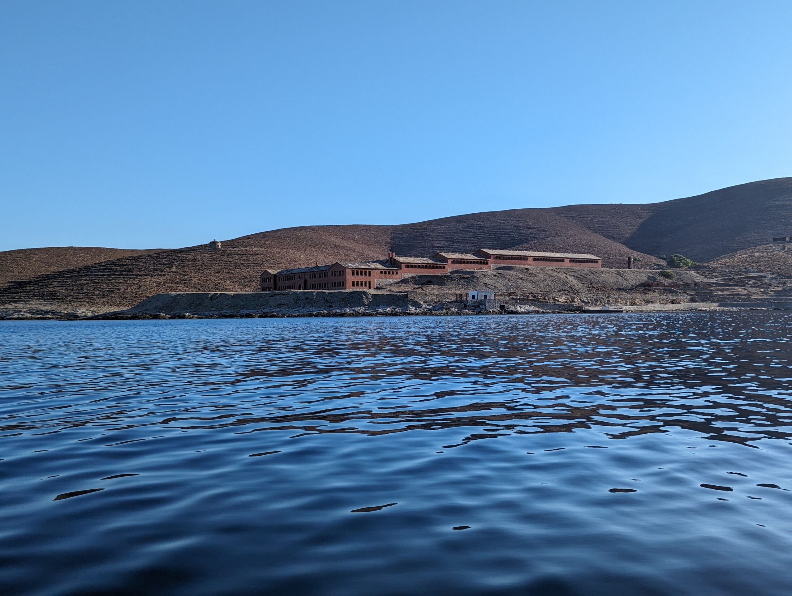
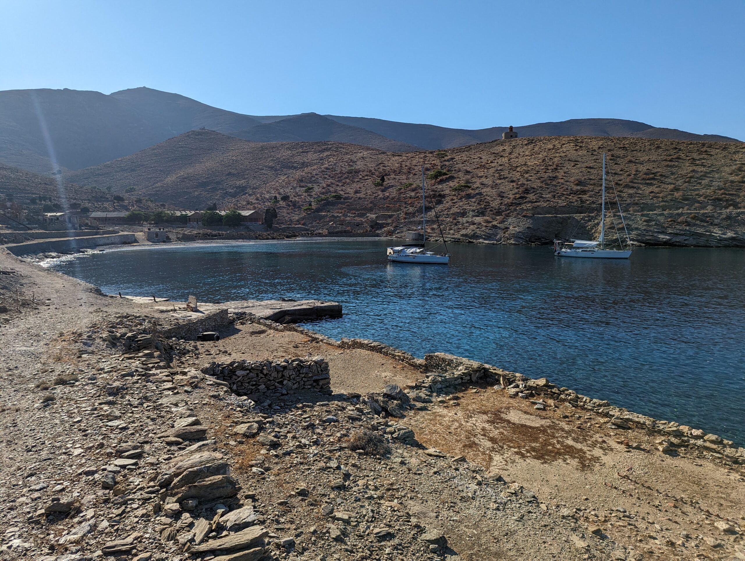
Gyaros is the Alcatraz of the Greek islands. It is a barren, waterless island used by the Roman Empire in the 2nd century AD as a place of exile. Between 1948 and 1974 approximately 22,000 left-wing dissidents were imprisoned there, in red brick buildings and tents. The remnants of the buildings in which many were housed are mainly still standing. An interesting place to visit for a day but not one to stay. It is now a nature reserve, protecting native monk seals, with good diving, but roaming the island is dangerous as there are unexploded munitions, from its time post 1974 when it was as a target range for the Greek navy.
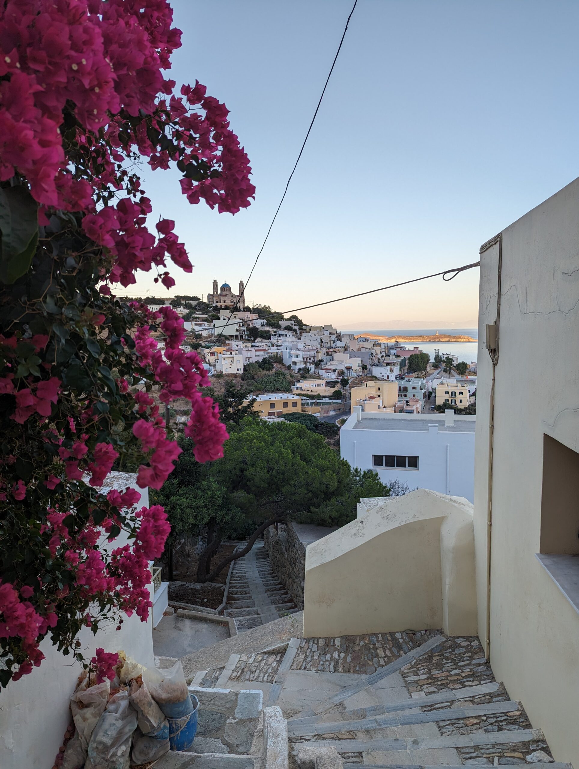
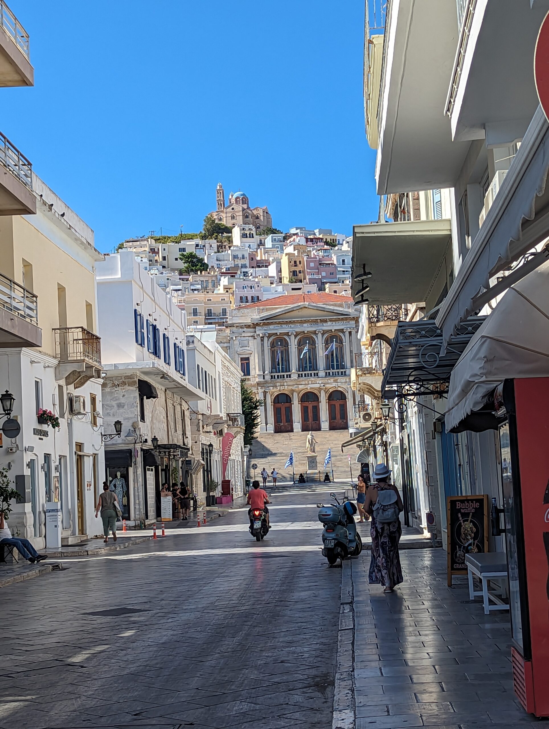
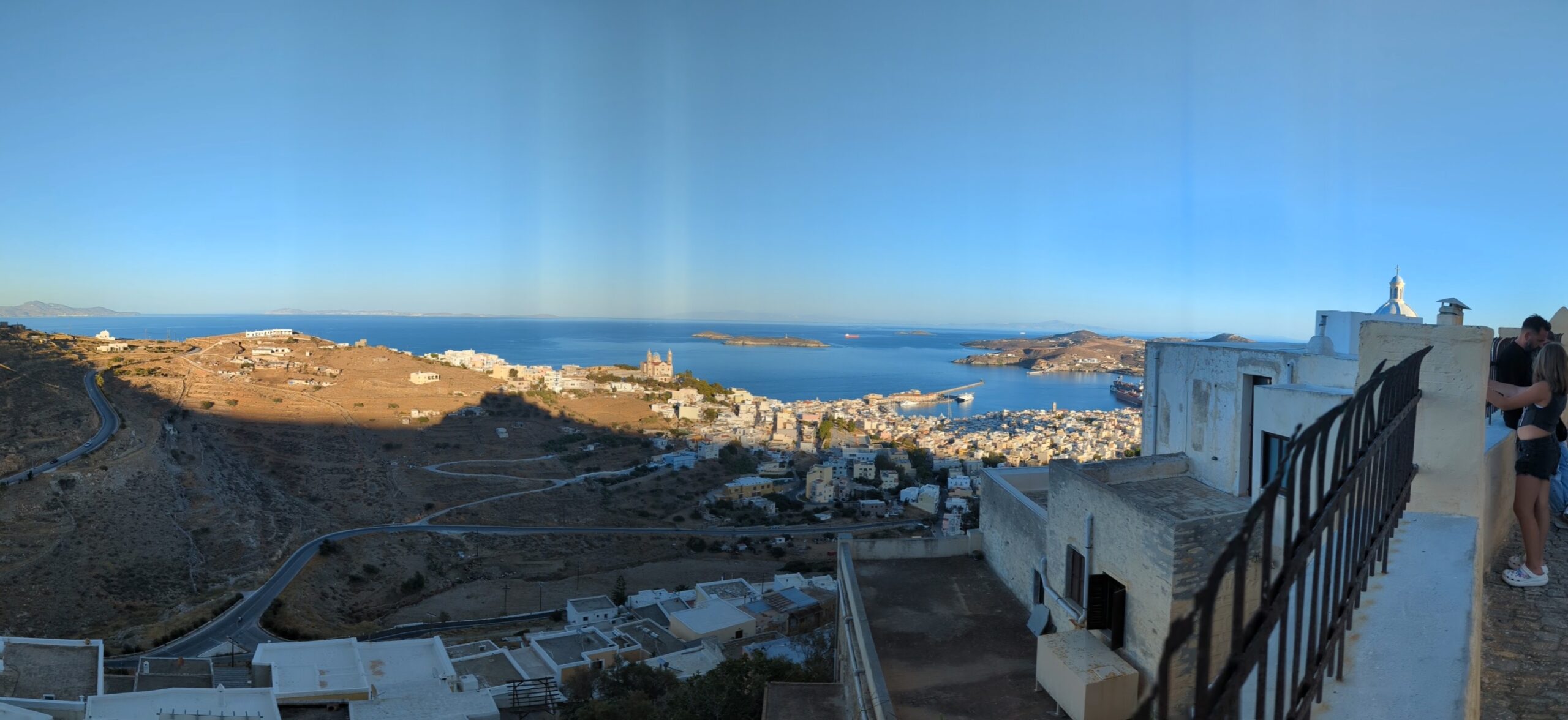
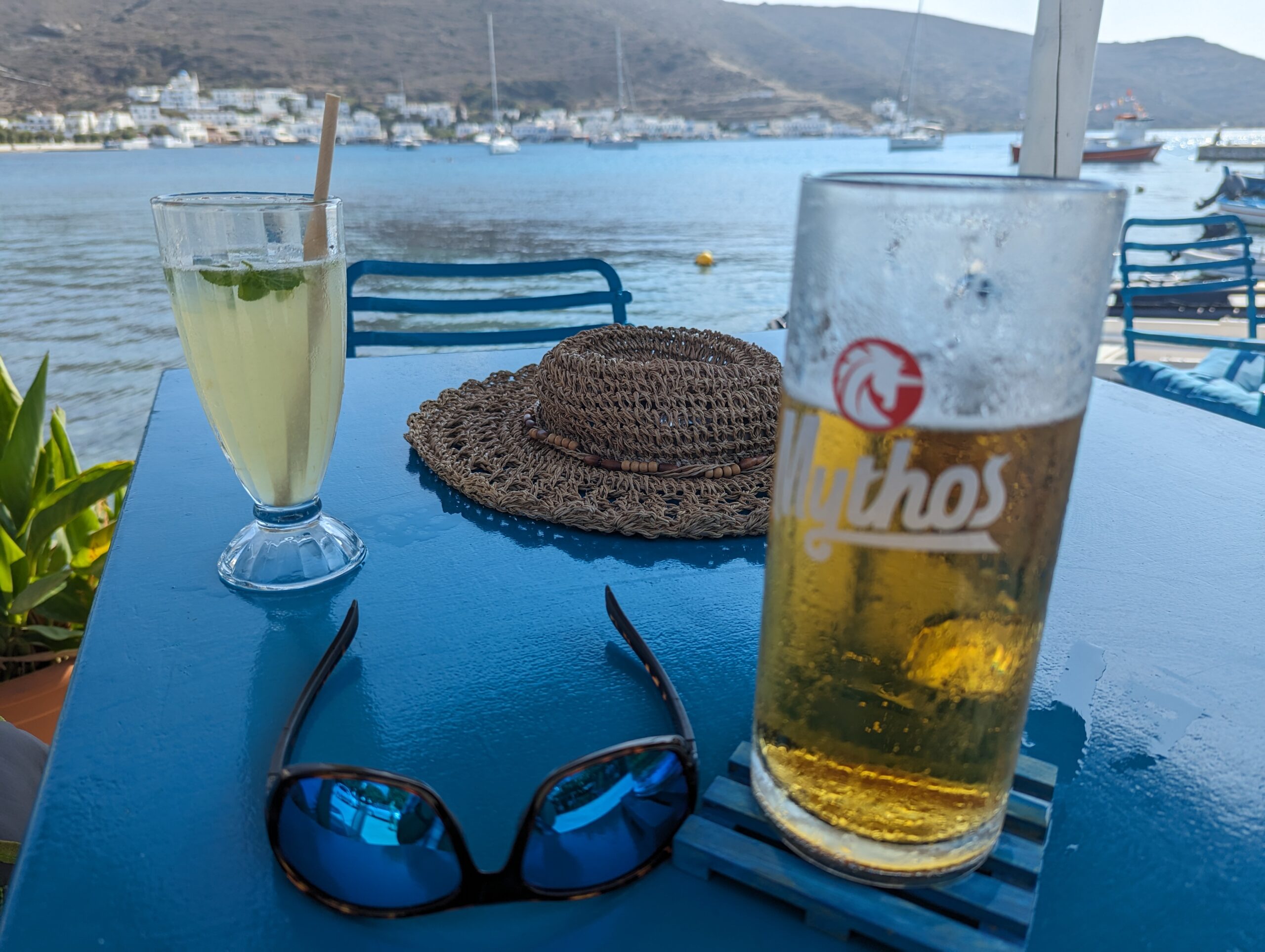
Next stop Syros, at Ermoupoli, the capital of the Cyclades. The 17nm passage involved some sailing, but the winds were still pretty light. Tinos, although a tempting stop, was passed to port. The harbour in Ermoupoli was supposed to provide good protection from the northerly winds of the Meltemi. In Ermoupoli port we were met by the brightly clothed harbour master, who initially was quite abrupt, as we had not booked a berth, but he quickly mellowed. As Syros is the capital island of the Cyclades it is well served with multiple daily ferries, the surge from which could be quite brutal, reflecting off the harbour walls. This, combined with the surge from the Meltemi, made the action of the boat in the berth quite unpleasant. The snatching of the stern lines attached to the dock, even with their snubbers, was most unpleasant and damaging. A cleat holding the stern lines on a catamaran next to us snapped off because of the snatching. However, despite all this we did manage to enjoy most of our time there; 5 days. A bus tour around the southern half of the island enabled us to obtain a better perspective of the island. Many of the beaches were crowded with tourists and Foinikas bay on the SW coast appeared to offer a good protected anchorage, although it was packed with boats sheltering from the wind.
Syros was first settled around 5,000 BC, so has plenty of history, although not many ruins. Between 1820-70 Ermoupoli was rebuilt in the neoclassical style, resulting in many fine buildings, such as the Apollo Theatre, a smaller copy of La Scala, Milan. There are many churches, including Roman Catholic and Greek Orthodox cathedrals, built on primary hilltop positions overlooking the city. During the days of sail Syros’ location was of importance. It had the first shipyard in Greece, Neorion, which is still operational. As sail gave way to steam Piraeus, near Athens, became the primary shipping port in Greece. Ermoupoli has the most impressive architecture of any of the Greek islands we have visited.
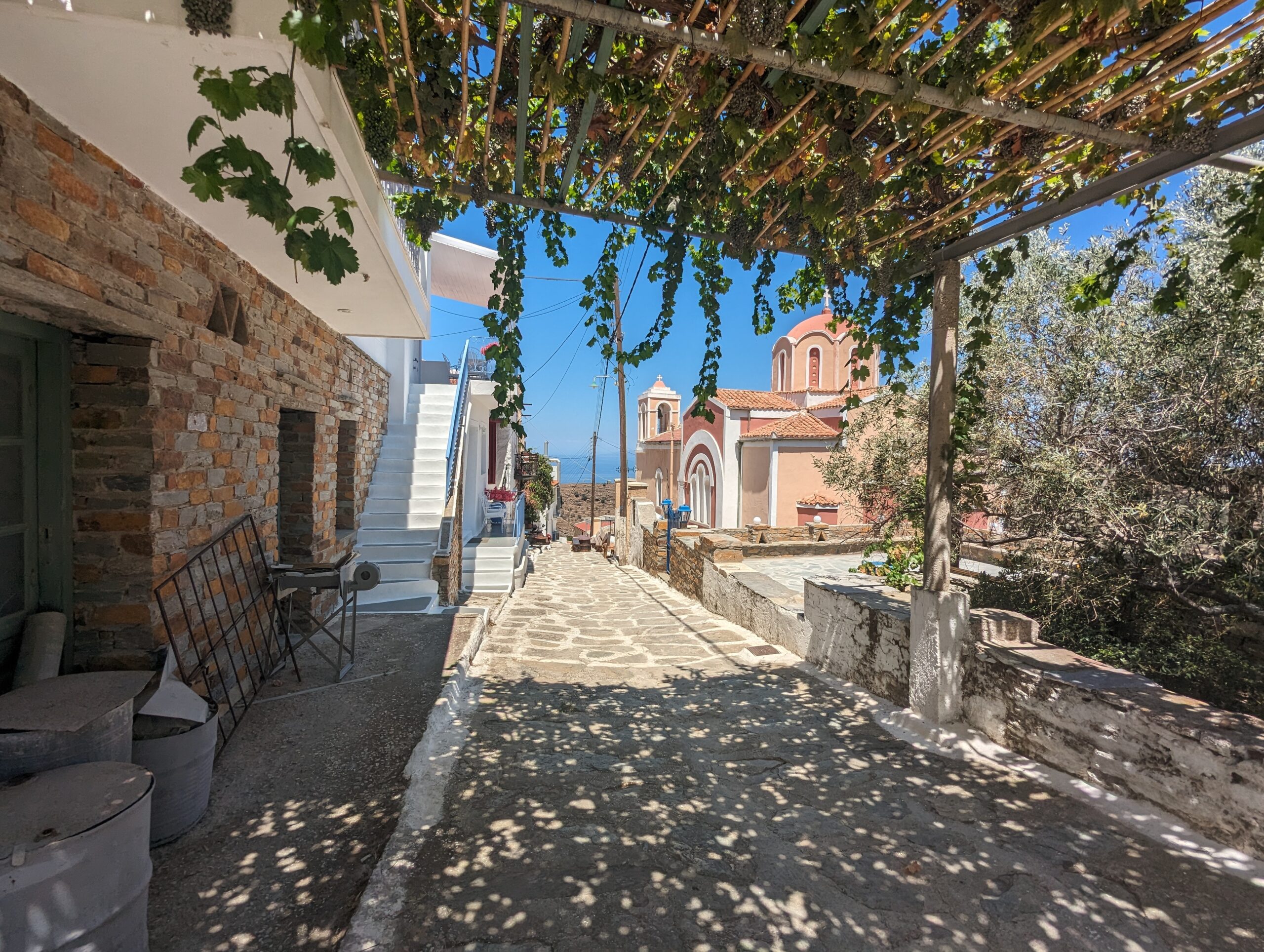
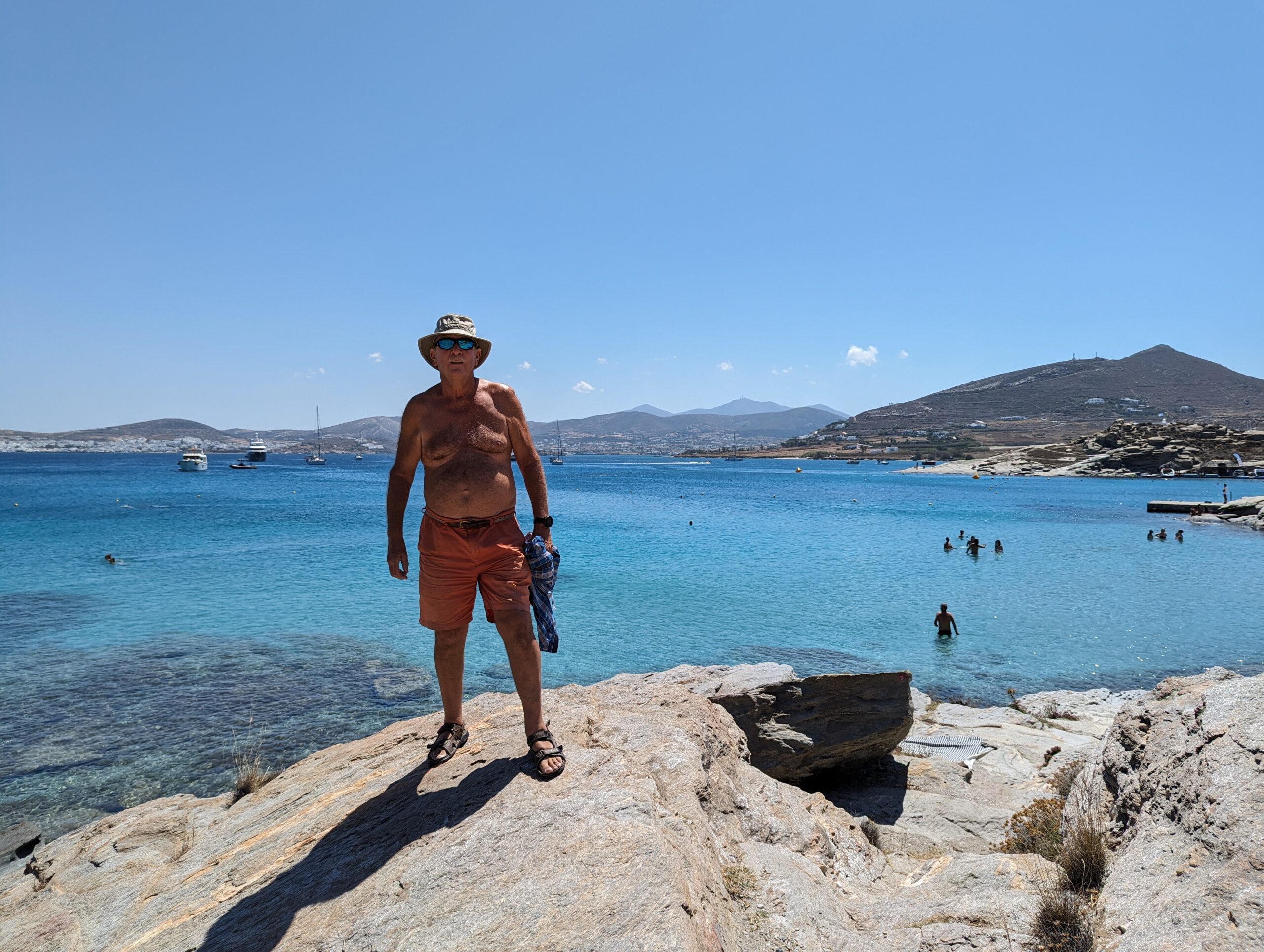
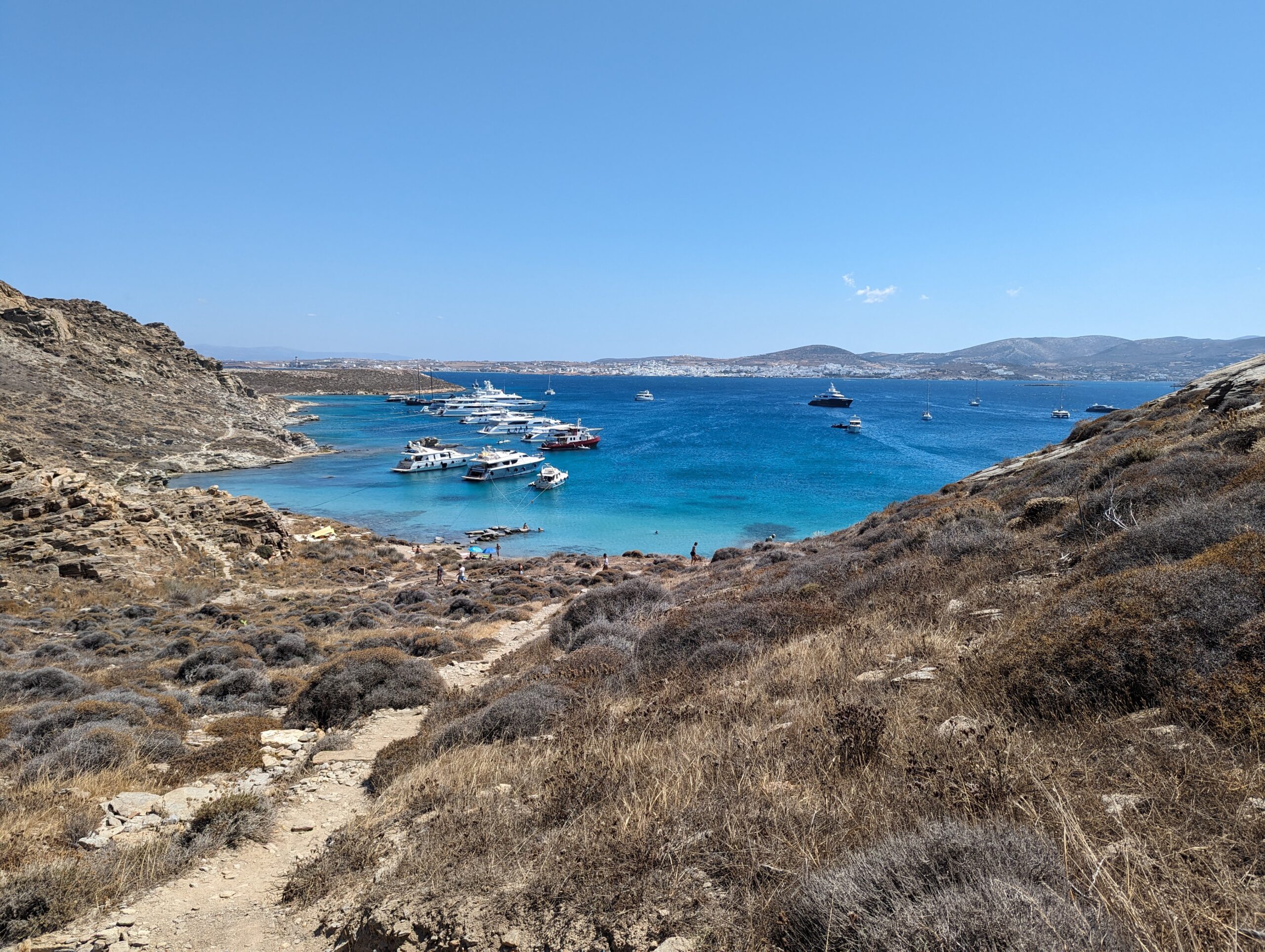
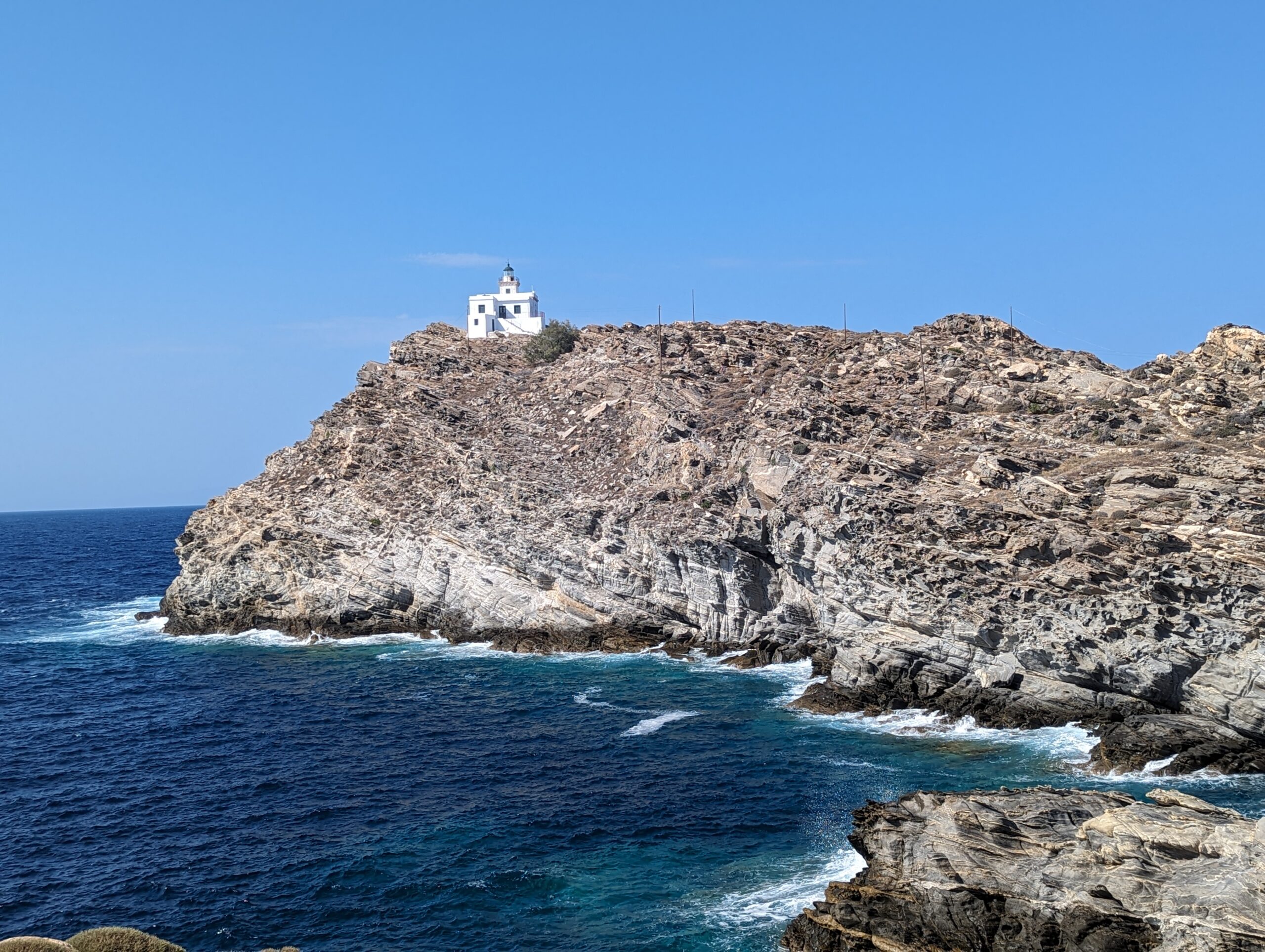
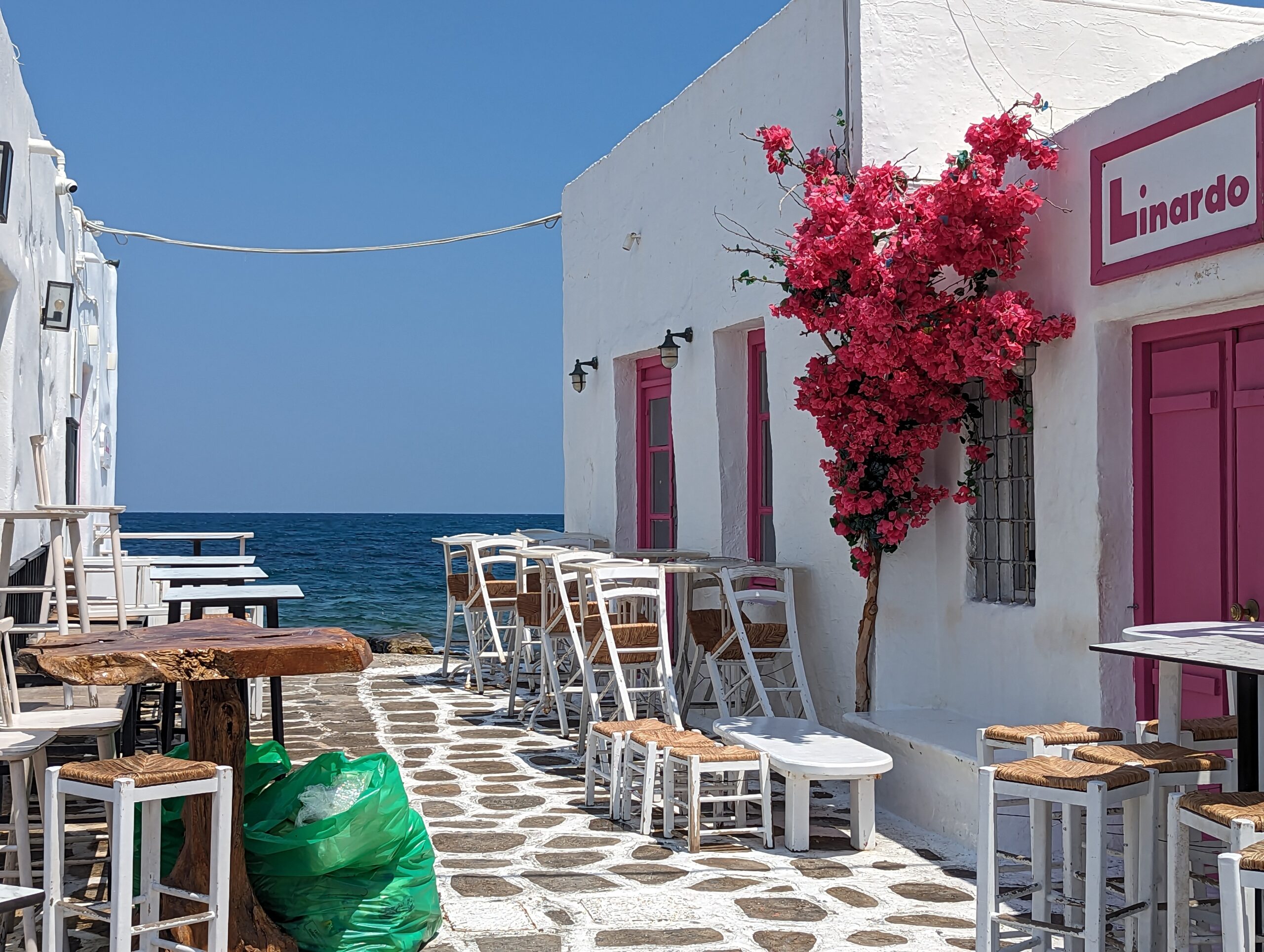
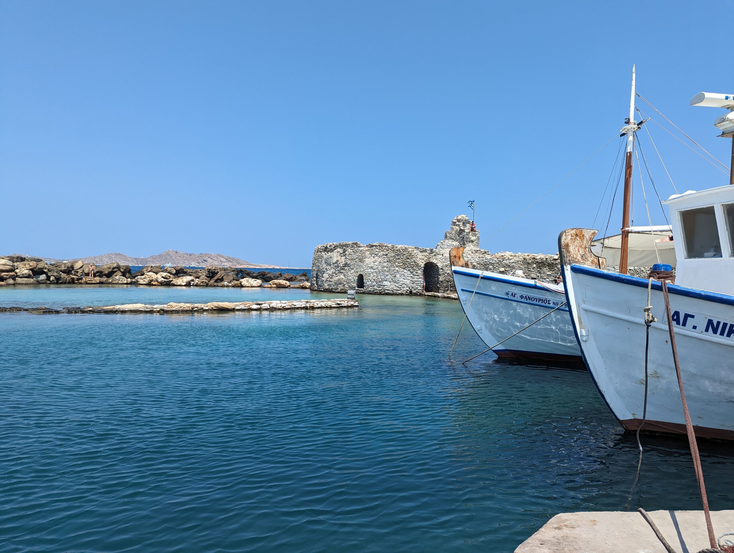
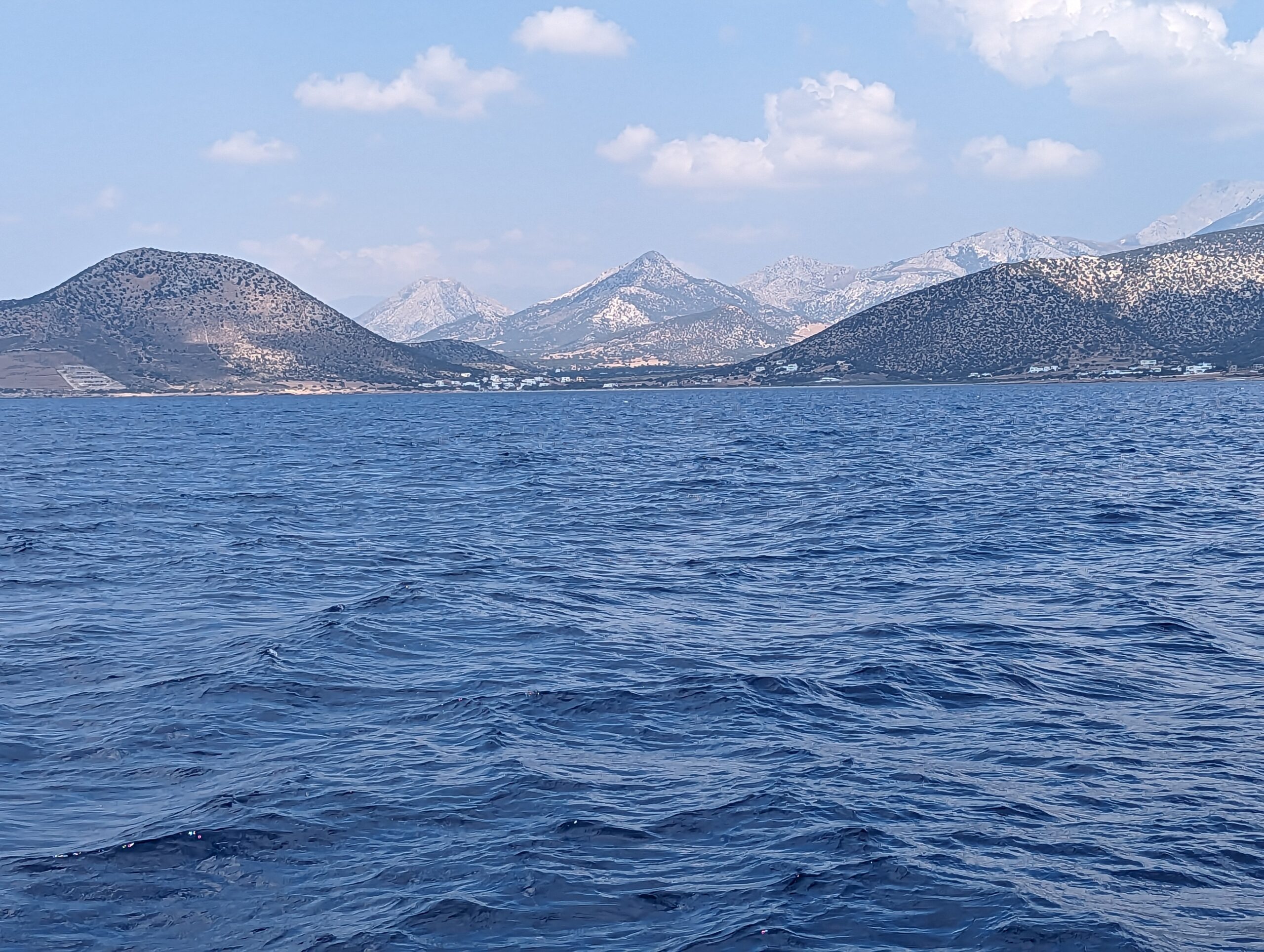
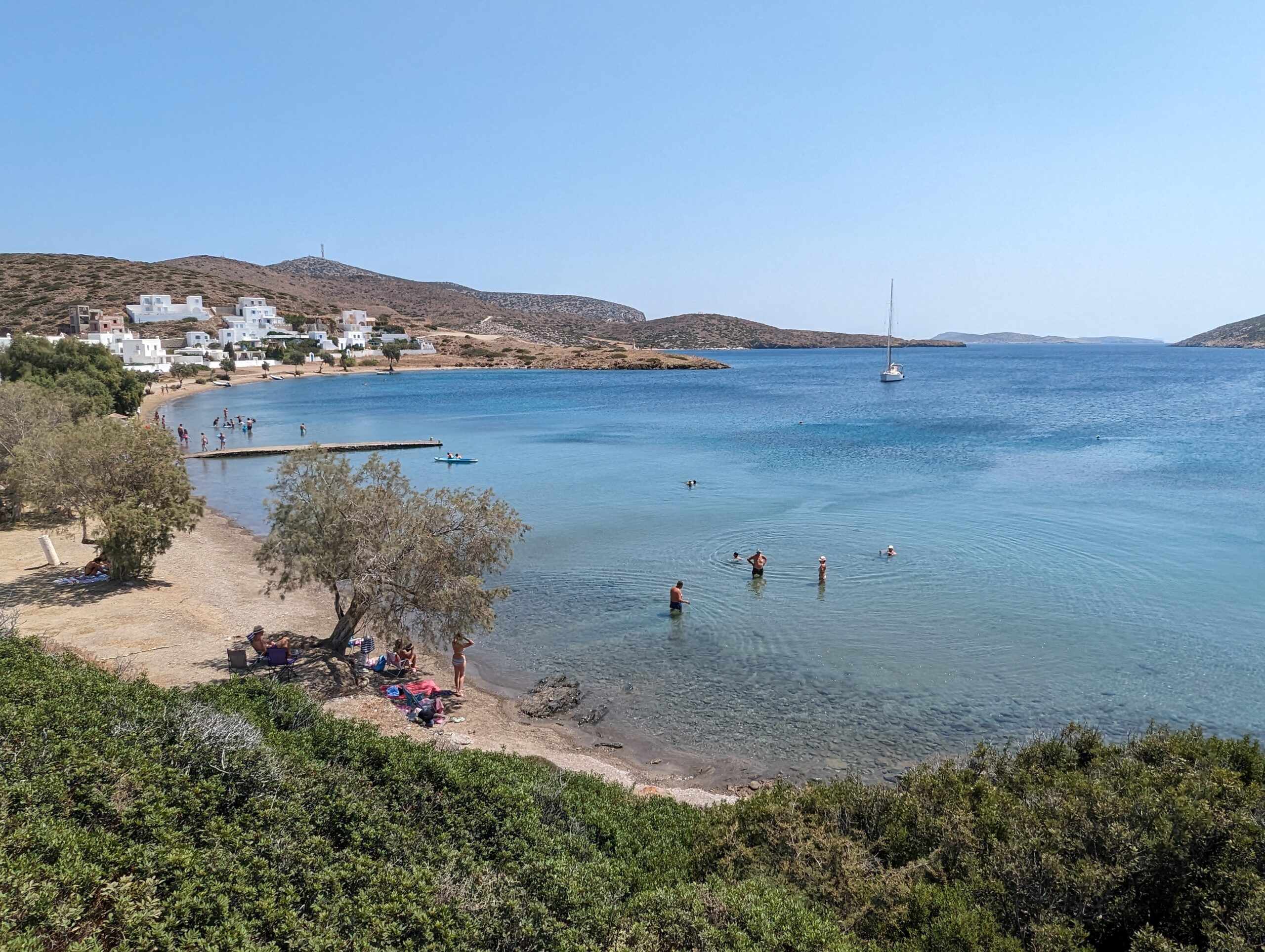
From Syros we sailed most of the 25nm passage to a bay on the N coast of Paros, an island SE of Syros. After the experience on the dock in Ermoupoli we decided to anchor in a safe, wind-protected bay rather than dock in the main harbour at Paroikias, on the NW coast of the island. The anchorage in the NW corner of the bay had steep cliffs to the north, which offered considerable protection from the next Meltemi blast. It was windy, upper 20’s, low 30’s but the sea remained relatively flat. We enjoyed the swimming and walks on the island, especially the one to the lighthouse. The small town town of Naousa on the south coast of the bay was much more vibrant than anticipated, full of tourists, very trendy, a small ruined Venetian fort washed by the waves, and a small harbour. Some friends from Finike had their boat there for a few days, so we had a few drinks with them.
Paros is renowned for its white and translucnt marble mined in hils in the north of the island. However, nowadays, like most of the Greek islands it survives primarily on tourism. There are about 6,000 Greek islands but only about 280 with any population.
While in Paros we had contemplated taking ferries to either Dilos or Santorini, but that would have involved leaving the boat at anchor, unattended, for one or two nights. This was not something we were willing to do, too much risk. We may get to Santorini by boat next year, but its reputation as an overpriced tourist trap is disheartening.
We stayed four nights in Paros before moving on to Naxos, where we anchored overnight in Kalantos, at the southern tip of the very mountainous island. Even though there was not much wind at sea, in the anchorage the winds were blasting down off the mountains, although the sea was not too wavy. We took the dinghy ashore to the small harbor and wandered around. Nothing very much there apart from the sheep and two restaurants, one owned by the harbour master, who took our line at the dock.
Naxos is the largest of the Cycladic islands and was renowned as a source of emery, a rock containing corundum, used in abrasives. According to Greek mythology Zeus spent his youth in a cave on the island.
After overnighting in Naxos we sailed downwind, at up to 7.9 kts in 20 kts wind, the 6 nm SE to Schoinousa, a small island en route to Amorgas. We anchored in a protected bay on the west coast of the island. We stayed there a few days, walking uphill to the village for an evening meal on two occasions, snorkelling to clean the hull, and having some drinks and a curry with Mike and Sandra, who had sailed with us on their boat from Paros, and enjoying pork chops cooked on our BBQ.
The next stop was Amorgas, an island to our east. Although the winds in Schoinousa were mild as soon as we were past the islands to the west of Amorgas the winds were at 28+kts and the short steep seas covered in white-caps/horses. We thought of retreating to an anchorage in Koufonisos, to the NW, but given the winds we returned to the benign conditions of Schoinousa. The next day we were determined to make the 22nm passage to Katapola, about one third the way along the north coast of Amorgas.
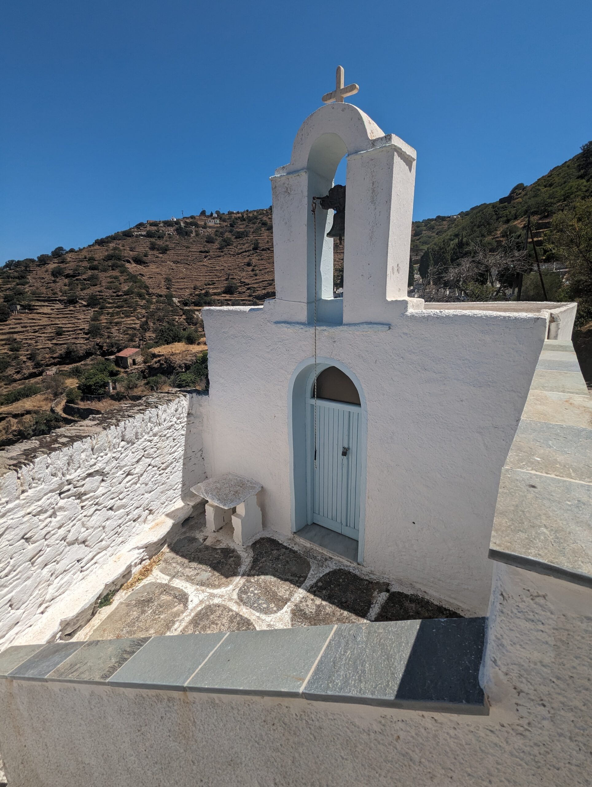
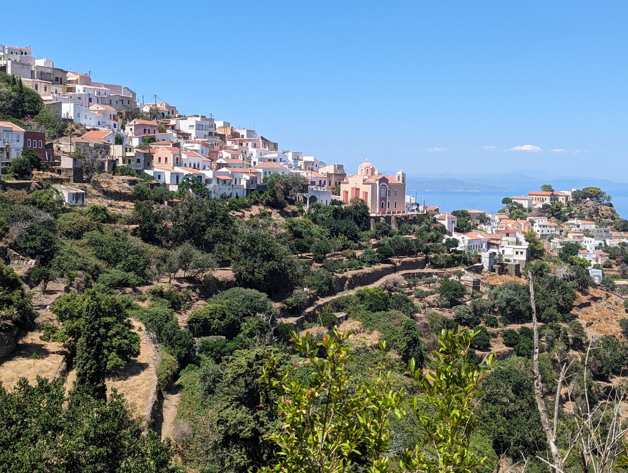
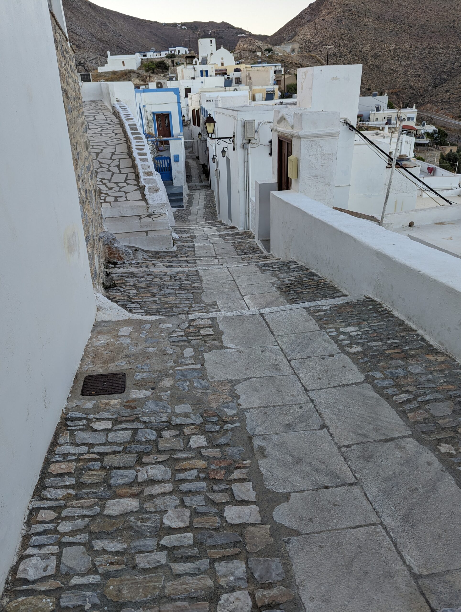
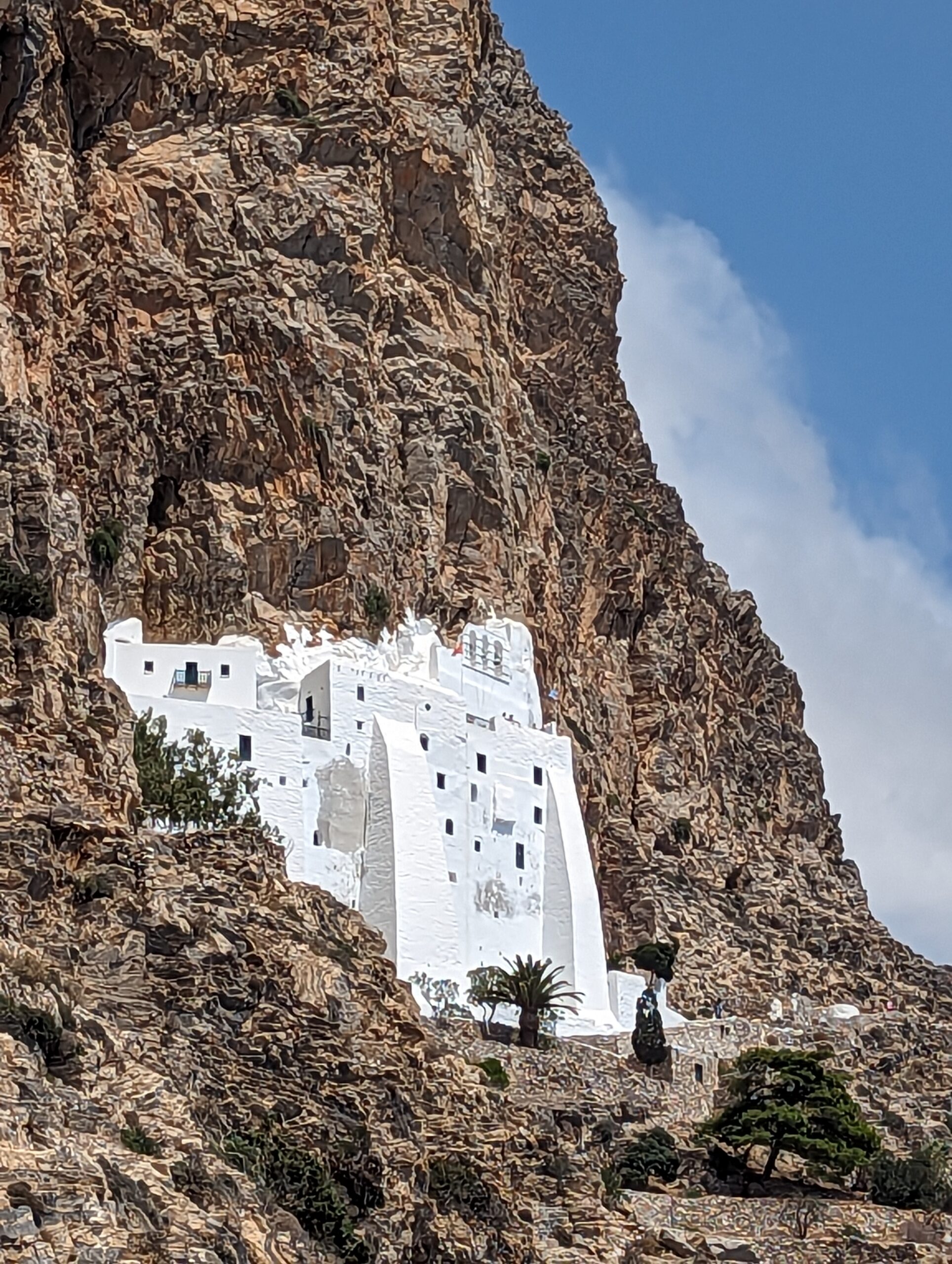
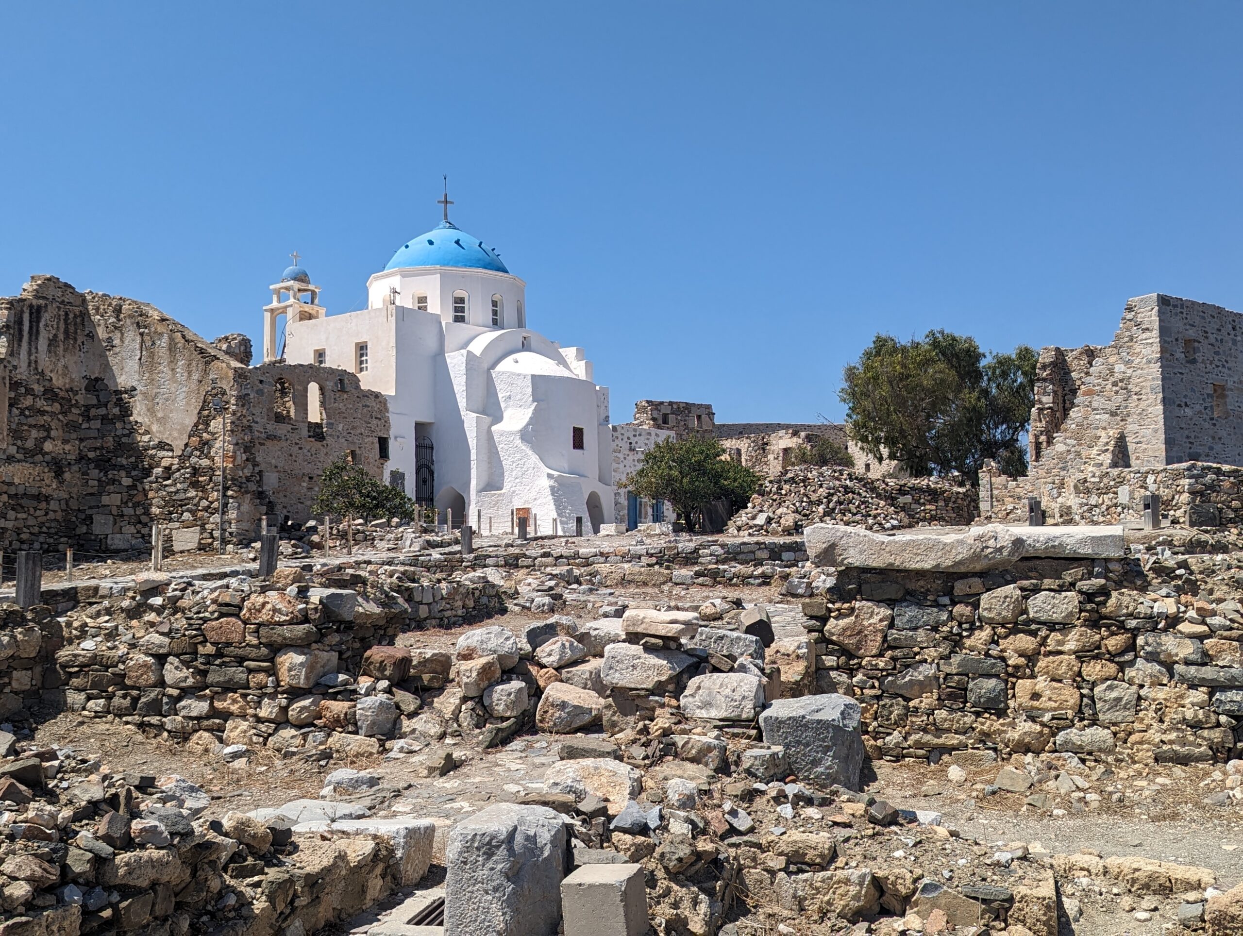
The passage to Katapola, like the previous day it started with moderate winds but nearing the west coast of Amorgas it was back to 20+kts from the N/NE. With reefs in the main and genoa we had to tack NW to make our destination. This meant sailing into the waves which dropped our speed through the water from 6-7 kts to around 3 kts; slow going. However, after about 4.5 hours we were safely anchored in the Katapola, a pleasant town with good ferry service, hence lots of tourists, and an island known for its hiking and spectacular monastery built into the cliffs overlooking the sea on its south coast. The following day we took a bus, modern diesel with stick shift for the hairpin bends and steep inclines, to the monastery. The path to the monastery was quite precipitous and definitely not for those with vertigo. Why anyone would build such a structure in such a difficult and demanding location begs belief.
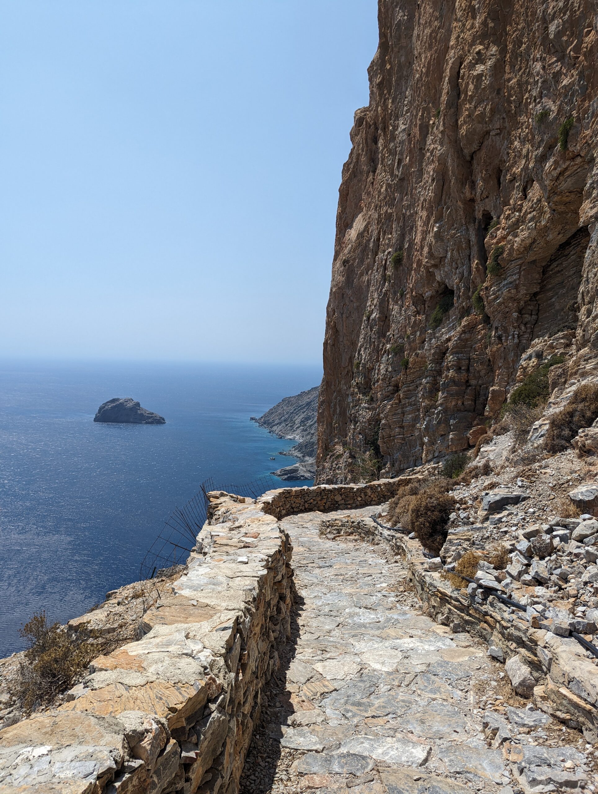
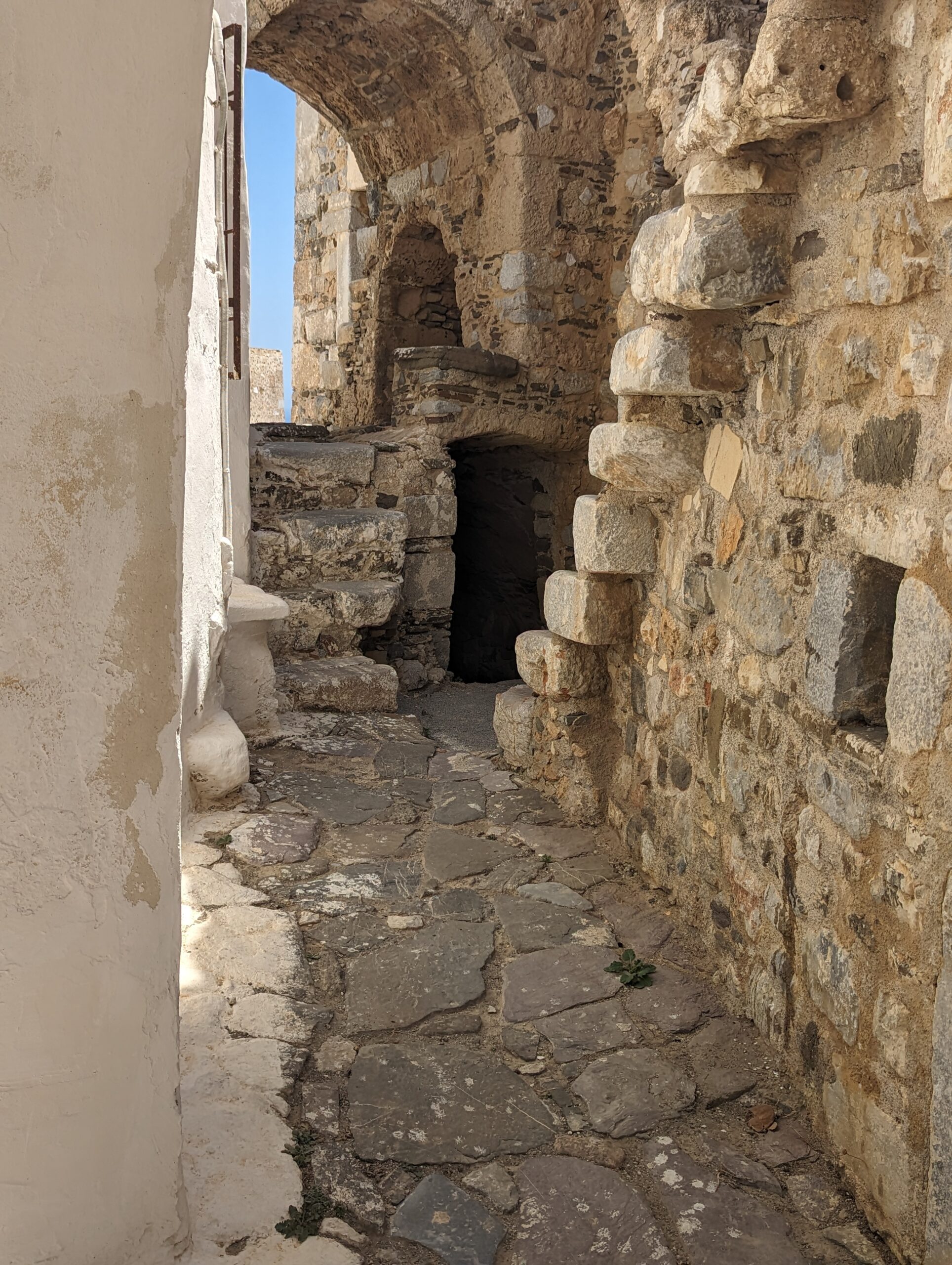
After wandering through the narrow picturesque streets of the chora, and some lunch, we decided to hike the 3.5km trail, downhill to Katapola. The trail is ancient, often with substantial stone walls either side, paved with slabs of stone in places, stone steps, and multiple cisterns, some still with water, for goats and sheep, when this was still an agrarian community. Building the path must have taken decades, but was the primary route from the bay to the chora in days of old.
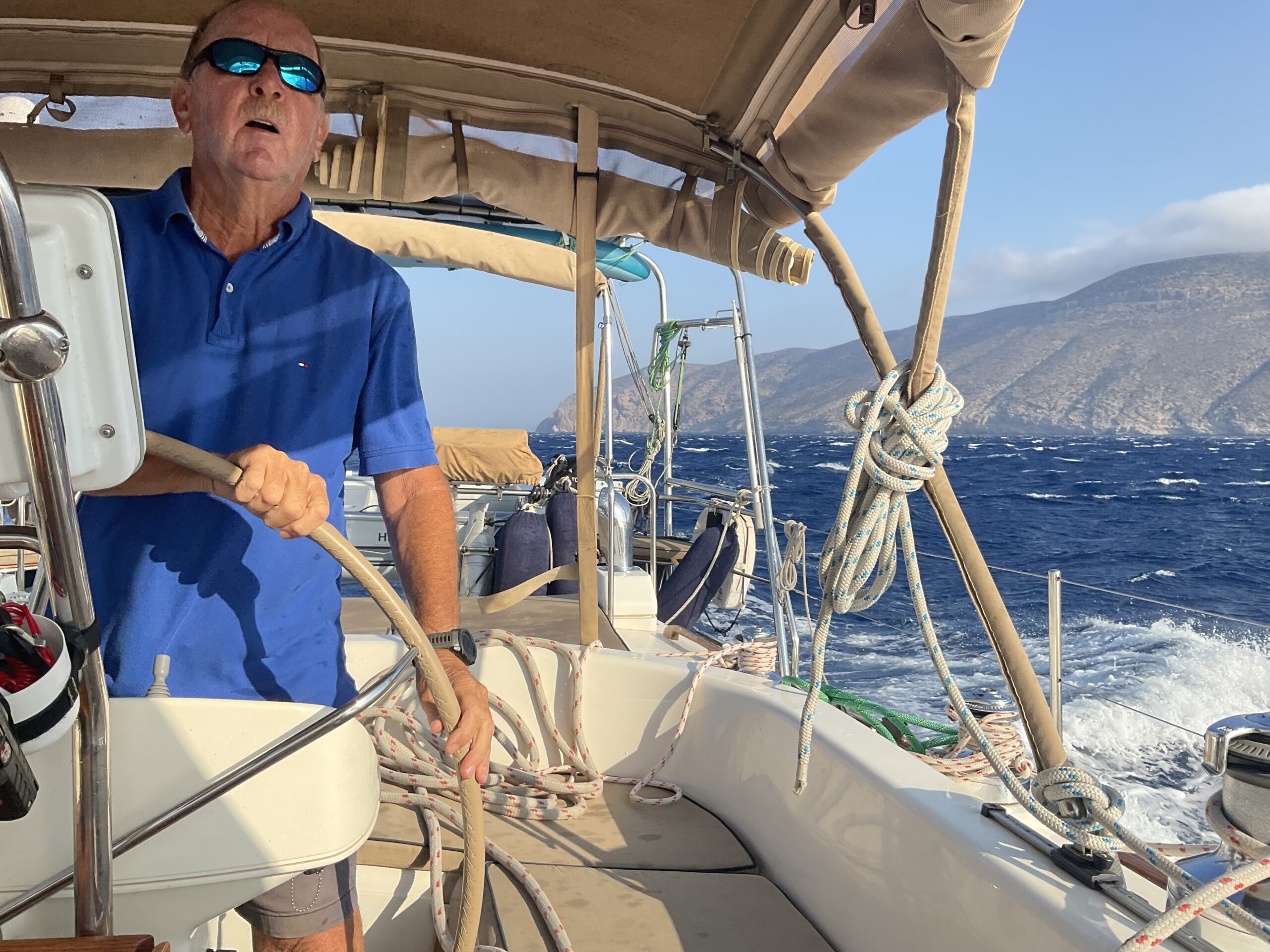
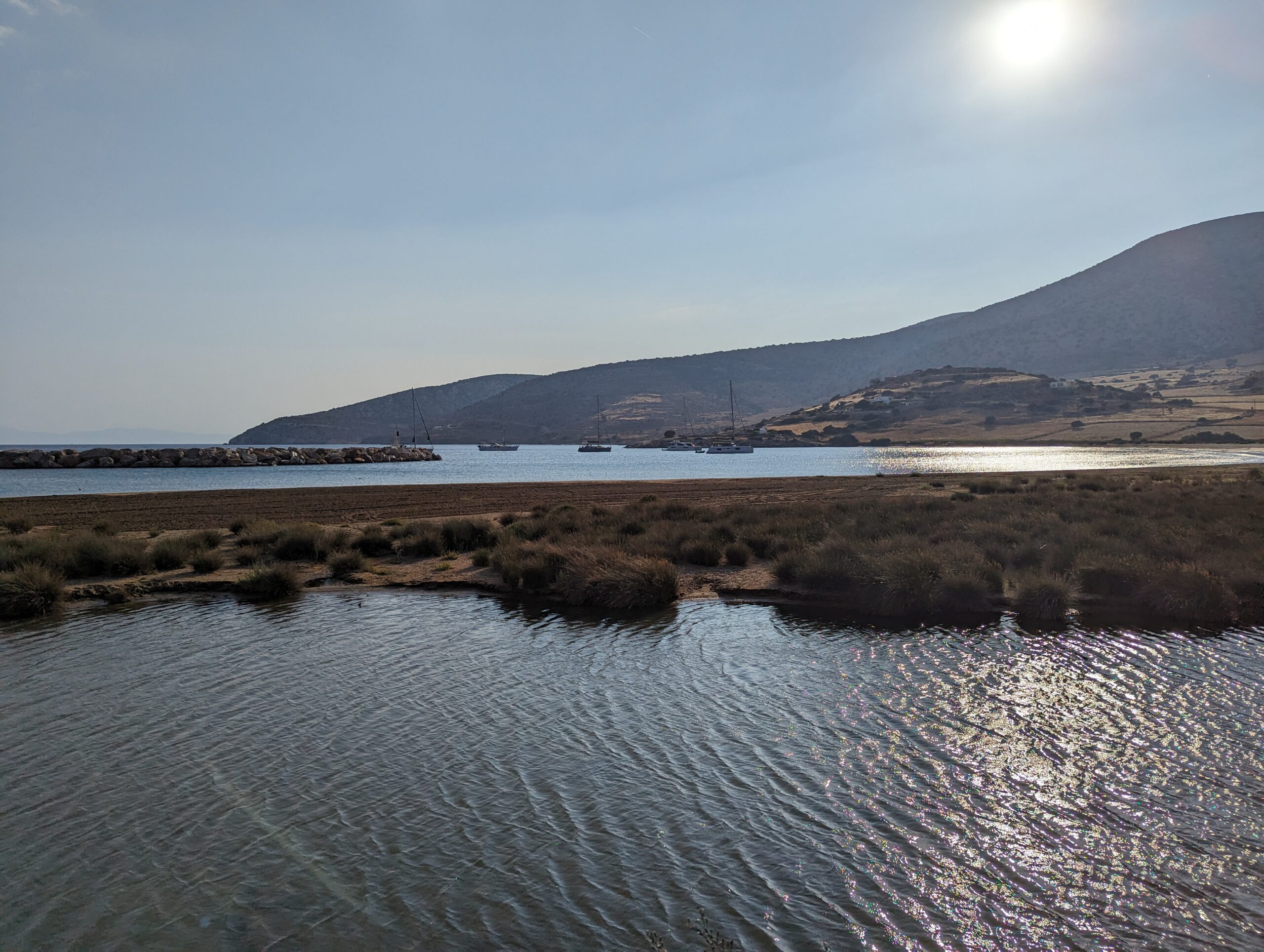
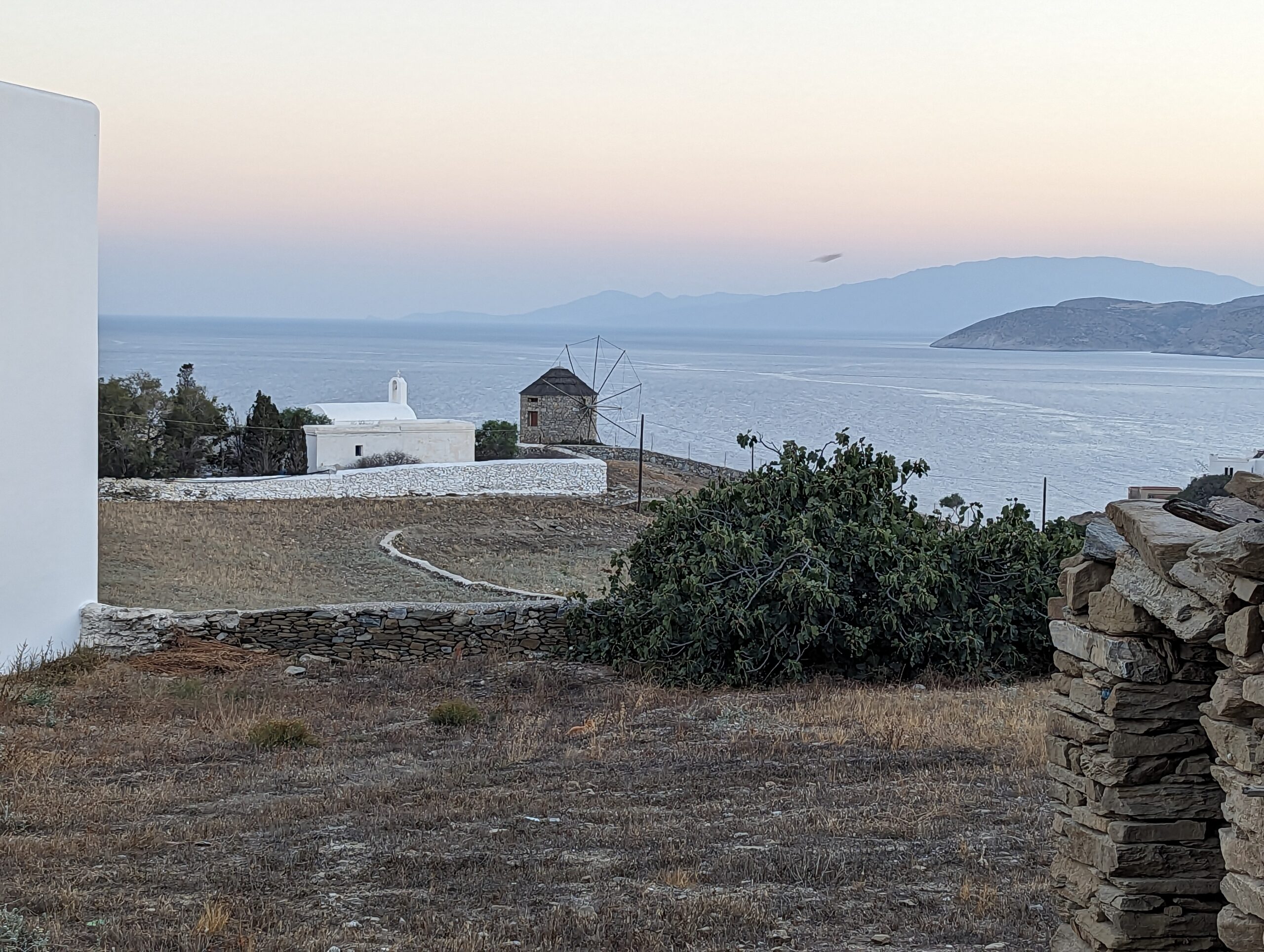
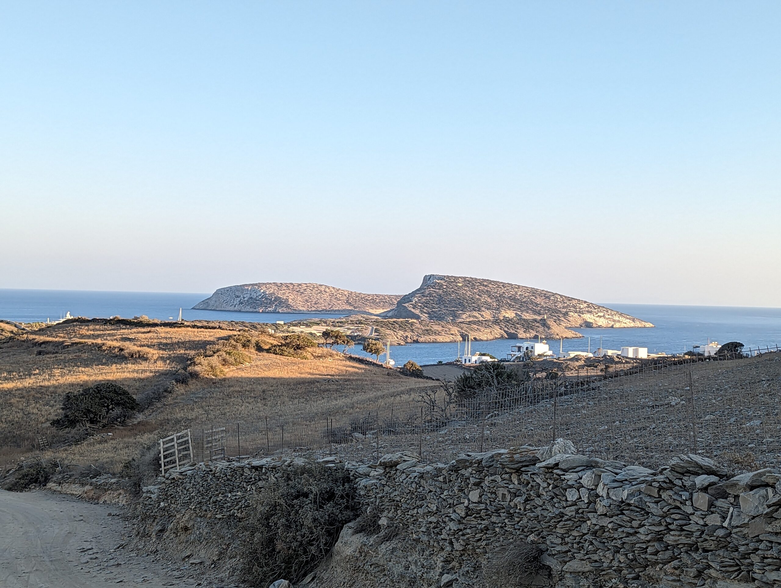
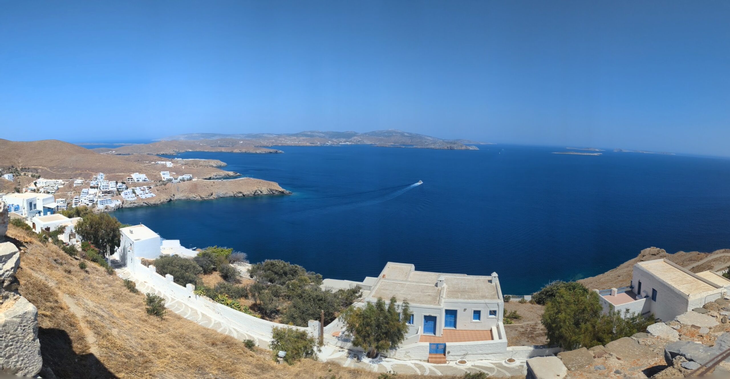
From Katapola we headed to Astypalaia, which involved heading west around the western tip of Amorgas and then SE, on a 50 nm passage. The winds on the north side of Amorgas were quite benign but as soon as we rounded the corner they rapidly went from less than 10kts to the mid to upper 20s. Fortunately, we reefed fairly early, having seen the sea state and felt the wind while at the monastery the previous day. The winds off the mountains to our north provided some ’exciting’ sailing, with speed through the water at over 9kts on occasions. The seas between Amorgas and Astypalaia were quite lumpy, until we reached the bay on the south side of the island. The island looks like a butterfly on the chart. The forecast for the area was gusts of 12-16 kts, in reality they were 22-26 kts, with low, hazy visibility. As we were heading north into the wind to reach our anchorage it meant motoring, no sails, into steep seas, quite demanding. 7.5 hours after leaving Katapola we were once again safely anchored in a small bay, all by ourselves. Astypalaia is the westernmost of the Dodecanese islands. It is a very quiet island serviced by the occasional ferry (11 hours from Athens) and smallish plane. The population in the winter is around 250. There are a lot of holiday homes, mostly owned by Greeks, but few other tourists. We took a bus ride to view the island and visit the main town. The Venetians built a castle in 1413 on the steep hill overlooking the town and harbour. Definitely a place to relax, far from the tourist masses. We enjoyed our time there.
However, we had to move on as we are meeting some friends in Kos on August 30. The 30nm passage to Kamira/Kefalos on the southern coast at the western end of the island took about 5 hours, with some very pleasant beam reach sailing in 14-17kts of wind, at least for the first few hours.
We will be hiring a car tomorrow to tour the island and to stock-up, before sailing up the coast to Kos marina, where we will meet our friends. The destination plan for the next passage is Rhodes, via Nisyros, Tilos, and Symi.
5 Comments
Cheryll
Wow so interesting and varied. Had never considered that conditions might not allow much sailing. Thank you for allowing your followers this window into your fabulous adventures.
Richard T Scott
Dear Hope and Howard:
What a lovely account of your progress through the Cyclades; you seem to have been fortunate with the weather for the most part, but most of all you have earned the time and the means for your voyages; critically, you have each other’s congenial company and ” a tall ship and a star to steer her by”, which I think is from the first poem that ever learned, in the Prep department of Omagh Academy in about 1944! We wish you the very best for gentle zephyrs and continuing good fortune in your progress, and perhaps you’ll continue to keep us entranced with your exploration
Terrific photographs as well as the daily narrative of the mostly peaceful navigation. I can’t help feeling that John and Pat are looking down and approving of the journeys that they would love to have undergone, but are being performed and logged by yourselves, William and Karen.
Richard T Scott
Dear Hope and Howard:
What a lovely account of your progress through the Cyclades; you seem to have been fortunate with the weather for the most part, but most of all you have earned the time and the means for your voyages; critically, you have each other’s congenial company and ” a tall ship and a star to steer her by”, which I think is from the first poem that ever learned, in the Prep department of Omagh Academy in about 1944! We wish you the very best for gentle zephyrs and continuing good fortune in your progress, and perhaps you’ll continue to keep us entranced with the account of your exploration.
Terrific photographs as well as the daily narrative of the mostly peaceful navigation. I can’t help feeling that John and Pat are looking down and approving of the journeys that they would love to have undergone, but are being performed and logged by yourselves, William and Karen.
Jenny
What a wonderful travelogue! Jenny
Nick Pearman
So much detail here for other sailors and would-be sailors. So appreciate all the effort involved in recording your voyages in words and wonderful pictures, allowing your friends and family a glimpse into a world far removed from ours! Thank you!
Ruthie xoxo