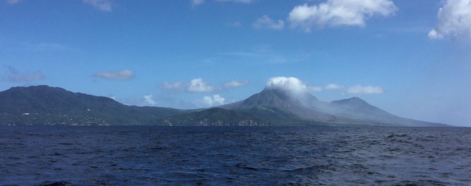
The ~34 n. mile passage from Nevis to Montserrat ended up being closer to 41 n. miles because we had to make a couple of tacks en route. Even though we were reefed, it wasn’t a particularly comfortable trip due to the lumpy seas generated by the stiff breeze. However, we did have the company of a Goldstar 50, ‘Calypso’ who happened to leave Nevis about 5 minutes before us. Being downwind of the island, as we approached, we could smell the sulfurous odor of the volcano several miles out. We anchored in Little Bay at the NW end of the island, which is really the only port since the southern end of the island was evacuated due to the volcano in 1997. We thought we had left a clear passage for the ferries, etc. to reach the dock but ended up being asked to move, not just once but twice! When we saw the large container ships that later arrived in the small port, we could see why, however, life would be a lot simpler for us cruisers if only they would mark the channel. If there is space, the best spot seems to be up close to the bluff, well out of their way.
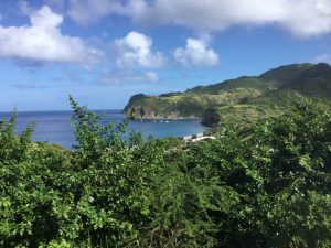
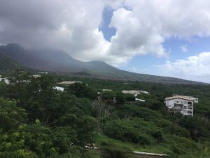
The following day we took a taxi tour of the island with Jonathan and Christine from Calypso. While we did stop to take a quick peek at the botanical gardens, the main focus of the tour was the devastation caused by the volcano and included an explanatory film in the Montserrat Volcano Observatory. The Soufriere Hills volcano first erupted in 1995 with major eruptions in 1997 that led to evacuating the capital, Plymouth, which was subsequently totally destroyed. We were taken to a vantage point where we could see the swath of lava flow that buried the majority of the city (see picture below), leaving only buildings a bit further up the valley on either side. It is one thing to read about such things but another to actually see it. There have been more eruptions and the collapse of the dome since then, but no major activity since 2010. We saw more lava flows that covered an incredible area on the western side of the island as we departed today.
Understandably many of the population (about two thirds of the original 11,000) decided to leave the island, many relocating to the U.K. and Antigua, with some help from the British government while others relocated to the northern end of the island which is protected from the effects of the volcano (other than ash if the wind is blowing in the wrong direction) by the Central Hills mountain range. This area of the island is lush with tropical vegetation. So, what with their tourist industry devastated, it is hard to see how the island is coping. As far as we could see, their only export is graded volcanic lava.
As the winds are forecast to increase in strength again over the next few days, we decided to make our way to Guadeloupe today. We had a much more pleasant sail and made it all the way to Deshaies on one tack. However our track on the chart plotter (and maybe also the satellite tracker) looks somewhat wobbly. I swear it is not because of any alcohol consumption on our part, but rather as a result of the fickle wind. The wind was generally in the 12-16 knot range but we encountered several rain squalls along the way when the wind increased to 20+ knots and headed us, then dropped to around 8 knots. It kept us awake! One benefit of having a faster boat is that we arrived here early in the afternoon, which was a distinct advantage when we saw quite a few other boats that arrived later search for a suitable anchoring spot. The pickings became slimmer!
1 Comment
Ruth and Nick
Found your blog and great pictures of Montserrat really interesting as had not realised about the exodus of population following the earthquake. And now you are in Guadeloupe! In good time for Sonia’s arrival and with time to explore and relax a bit more before 22nd, hopefully. Have a wonderful time and keep,the blogs coming until Sonia arrives when you will deserve some time off admin! R xxx